 Guide")
 Car Rental")
 Terminal")
 Security Wait Times")
 Lost And Found")
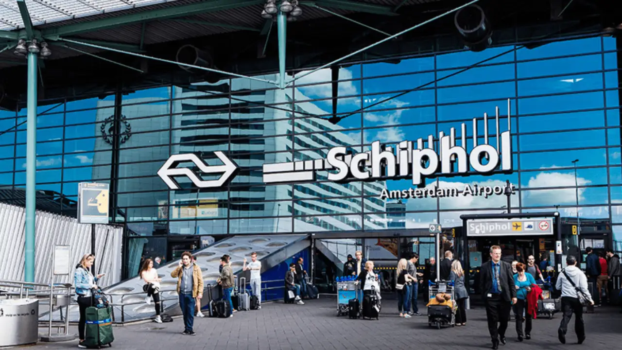
Amsterdam Airport Schiphol follows a single-terminal concept, but the terminal is divided into multiple halls and piers that handle different flights. This complex Amsterdam Airport Terminal layout creates confusion, especially for first-time flyers. However, a complete Amsterdam airport map is an essential tool for any traveller, whether they are departing, arriving, or in transit. By providing a clear layout of the terminal, gates, and various facilities, the airport map helps passengers find their way with ease, saving both time and stress.
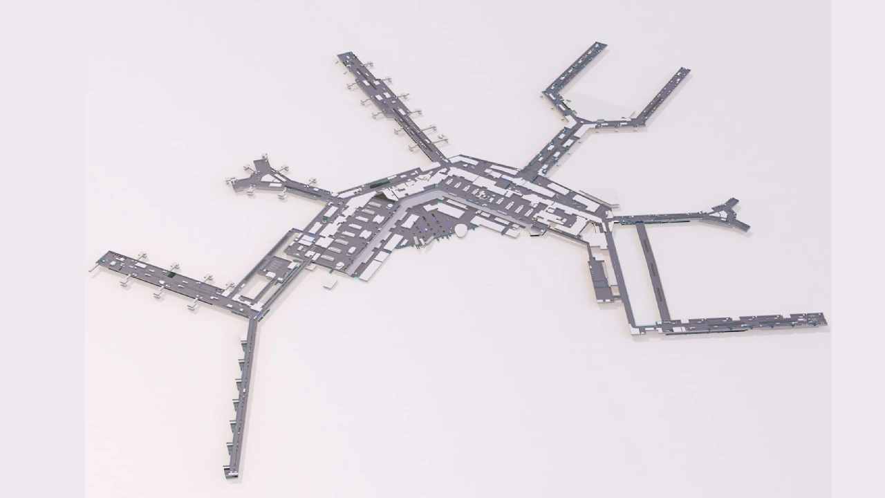
Amsterdam Airport Schiphol Terminal Map
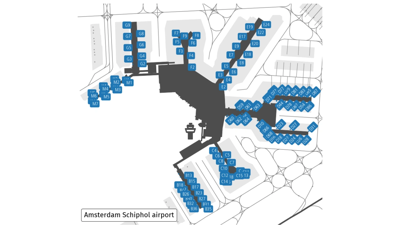
The Schiphol terminal map helps travellers understand the layout, highlight Schengen and non-Schengen areas, locate their boarding gates, check-in counters, lounges, shops, and dining areas.
AMS Airport Departure Hall Map
While the single-terminal concept at AMS airport may appear simple, the terminal is very large and divided into different departure halls and piers, which can be confusing without a clear map.
Amsterdam Airport Interactive Map
Whether someone needs to find their gate, locate a lounge, or choose a spot to eat, using the official Schiphol map is the most reliable way to move smoothly and easily through the airport.
View Larger Map
Frequently Asked Question
Yes, the map highlights Schengen and non-Schengen areas separately, making it easier for passengers to locate their gates.
Yes, lounges, rest zones, and relaxation areas are clearly marked on the airport map.
The map guides travellers through transfer routes, showing security checkpoints, boarding gates, and transfer desks.
Yes, the map highlights elevators, ramps, and special assistance points for passengers with mobility needs.
Yes, the map provides directions to train stations, bus stops, taxi stands, and car rental services located near the terminal.
Maps are available on the official Schiphol Airport website, at information desks, and on digital screens throughout the airport.